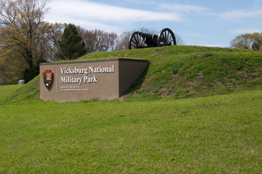
I arrived at the Vicksburg National Military Park late Monday morning March 19th. It was eighty five degrees and humid. My first stop was the visitor’s center for a quick orientation. I spent two hours at the center. The 20 minutes movie about the Siege of Vicksburg was very good. I recommend starting there. The museum displays show life in the tranches, an officer’s field tent, and a mock up of an underground civilian quarters. The movie covered some of the aspects of life within the city during the siege. The large wall map offers an eight minute presentation showing military movements around Vicksburg with a narration. I am not going to launch into a history lesson. Suffice it to say it was the Civil War and the Union needed control of Vicksburg to have free access on the Mississippi River. I recommend that you view this online site: https://www.nps.gov/vick/index.htm
One reason that I came to Vicksburg was to determine the burial site of my Great Great Grandfather George Brockway. He fought with the Indiana Infantry 100th Regiment Union Army at Vicksburg. A park worker helped me locate the units monument on the park map. It is on the northern tip of Sherman Circle near the area of Grant’s Headquarters in the northeastern most extent of the park.
George Brockway was at Vicksburg in 1863. His regiment moved to Big Black River. They bivouacked there at Camp Sherman in September. During that time George died from a non-described illness. He was buried near the camp. Later when the Vicksburg National Cemetery was formed bodies were transferred from a wide radius around Vicksburg to be laid to rest at the cemetery. The bodies were moved without consideration of forensics or identifications. More than 17,000 troops occupy the grounds. Almost 13,000 are unidentified. More than likely my Great Great Grandfather is among the ranks of the unknown.
The personnel at the visitors center are all very friendly, knowledgeable, and helpful. I spoke with them on multiple visits to the park. They gave advice on resources to check in determining my Great Great Grandfather’s grave. The answer was not what I had hoped for but I am satisfied that I have exhausted those resources.

The drive through the park begins at the Visitors Center through the Memorial Arch on Union Avenue. The entire drive is 16 miles long. A portion of the road was closed from above the National Cemetery along Confederate Ave. from Fort Hill to Graveyard Road. Union Avenue is a one way road that twists northward up and down along the Union line. You could spend days reading every memorial along the roadside. I drove slowly and acknowledged the states, or individuals being honored. I made stops along the way to view battle sites and the larger memorials.

The Illinois memorial by the Shirley House Marks the failed Union attempt to take the Third Louisiana Redan. I was reminded of the Pantheon in Rome when I entered the large memorial. Later I read that it had been modeled after the Pantheon. Confirmed. The winds were intense on the hill above the rolling valleys. The wind’s intensity was magnified when I stepped through the doorway. My glasses almost blew off my face. The walls are marked with large metal plates bearing the names of the Illinois soldiers who served during the Civil War. The apex of the dome has a circular opening allowing natural illumination of the interior. It is simple and impressive.
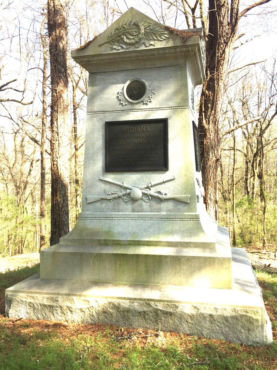
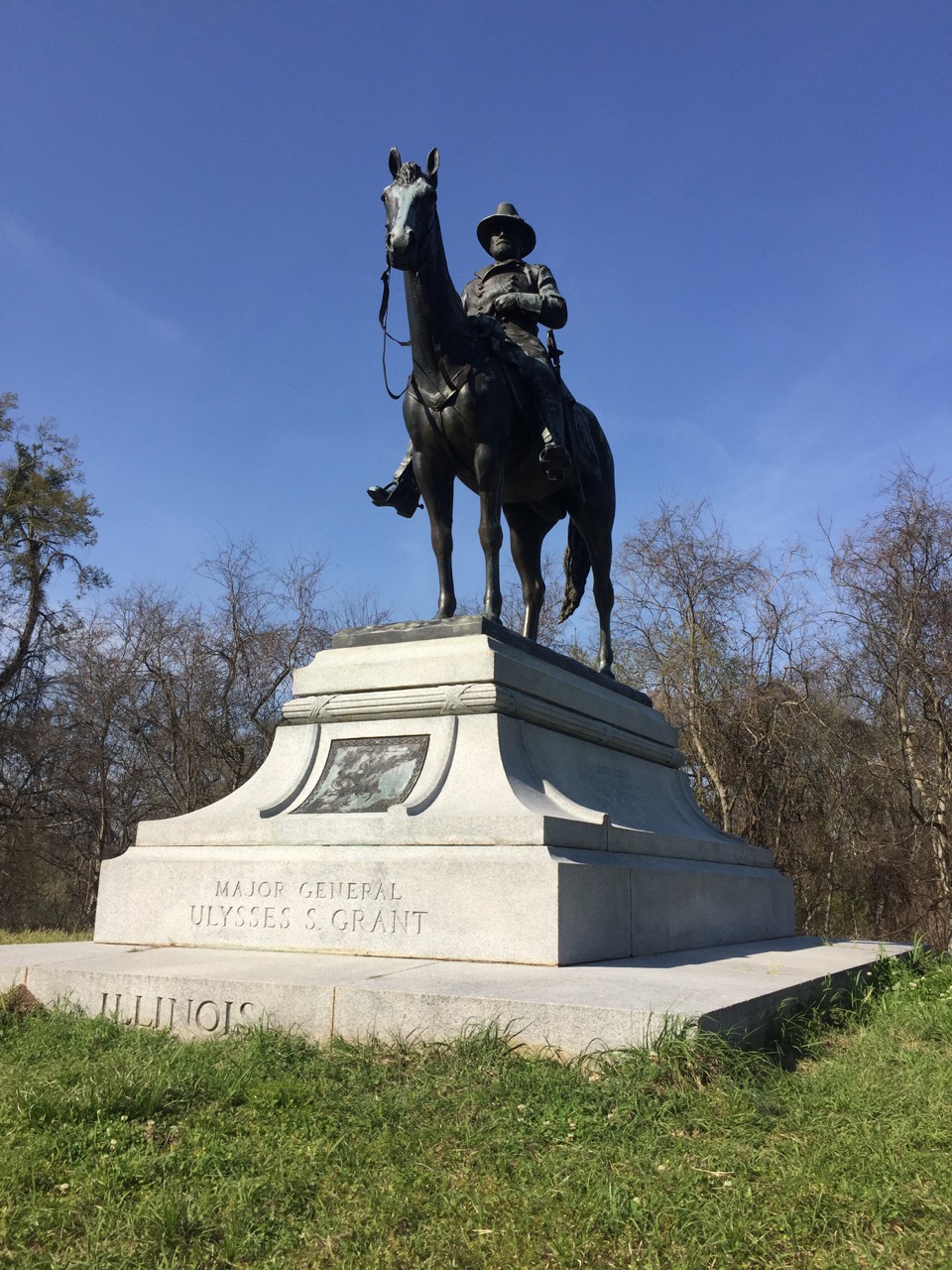
I continued north along the road. to the northeastern most extent of the park where I found Sherman’s Circle and located the Indiana 100th Infantry memorial. It sits above the road on the north tip of the circle. The paved circle is very narrow. I parked close to the edge but if another car had come along it would have been unable to pass. I resolved to climb the steep hill and took photos of the monument. It was a quick up the hill, snap, snap, down the hill, and on my way. Just down the road at the eastern most extent was Grant’s Headquarters area, replete with a larger than life statue of the General.
From that point I continued west along the road to the U.S.S. Cairo Museum and the National Cemetery across the road. The museum closes at 5:00PM and it was already 4:45. I parked and walked around a bit then decided to come back on Tuesday morning.
Tuesday March 20
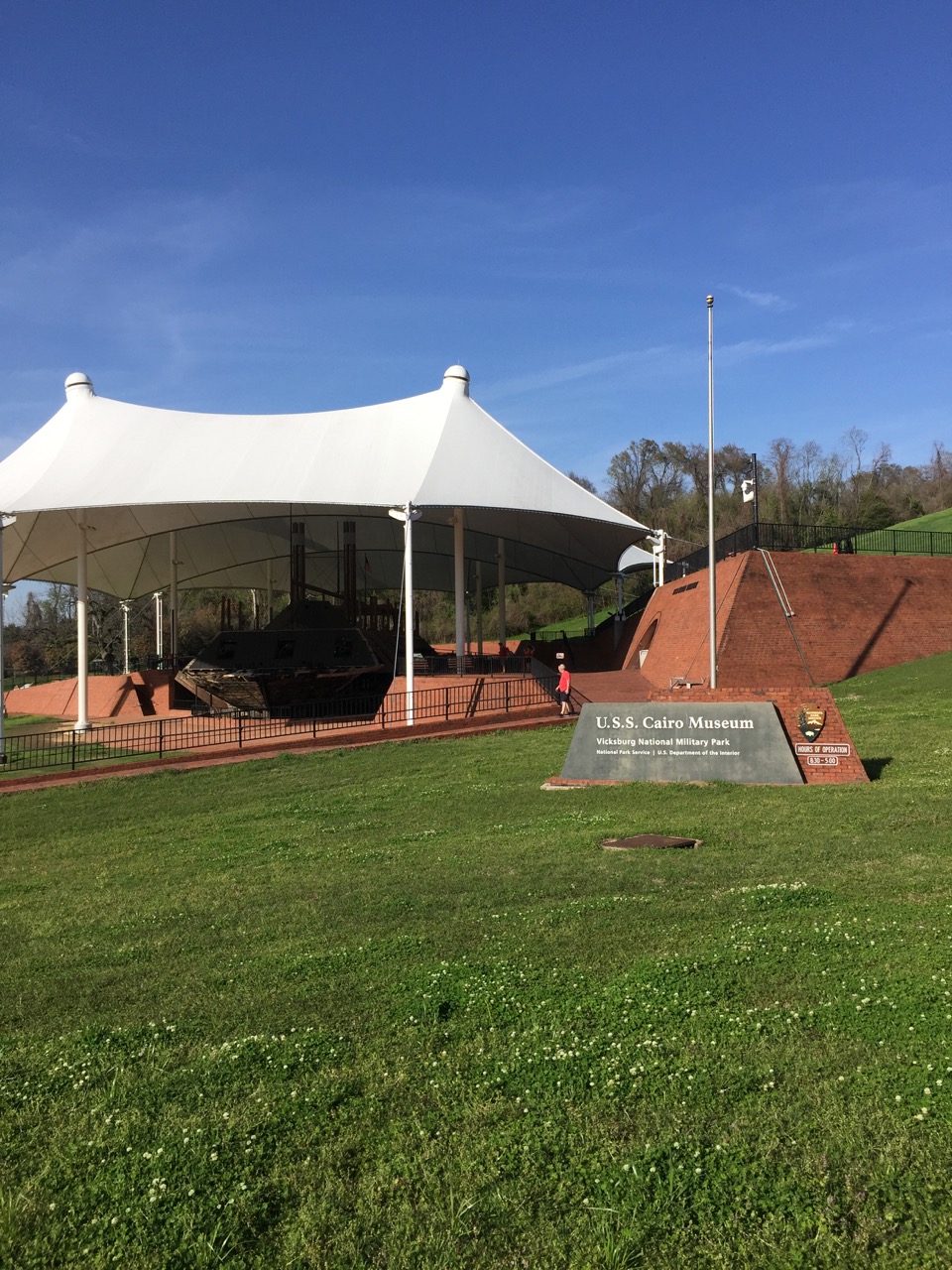
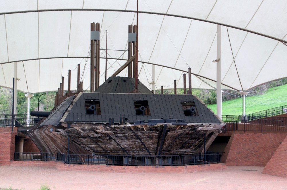
The day started off cold and only warmed to sixty degrees. A huge difference from Mondays heat. I returned to the Cairo Museum to investigate the historical iron clad. The museum holds many artifacts recovered with the shipwreck in 1964. It tells the story of the iron clad and her sister ships. The Cairo was sunk on the Yazoo River during a skirmish. It fell victim to a torpedo (mine). It was discovered in 1956 but was not raised until nearly a decade later. The excavation yielded a jigsaw puzzle of immense proportions. The assemblage rests under a large open sided tent. You can walk all around a platform to view the ship’s reassembled skeleton. There are points of entry on both sides toward the bow allowing visitors to cross the deck under the pilot house and peer below at the engine room with the coal powered boilers. The ship is a skeletal frame enhanced with reproduced segments that help to make it more tangible. It allows the visitor to experience this bit of history. Learn more about the museum at the official web site, https://www.nps.gov/vick/u-s-s-cairo-gunboat.htm
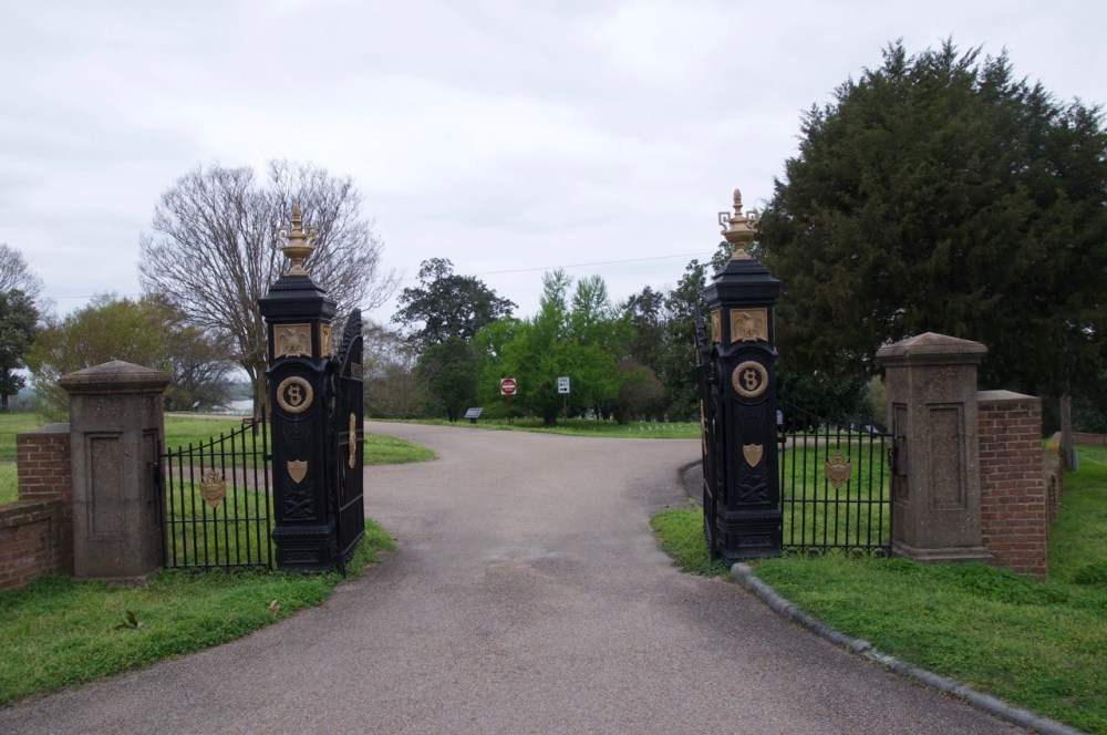
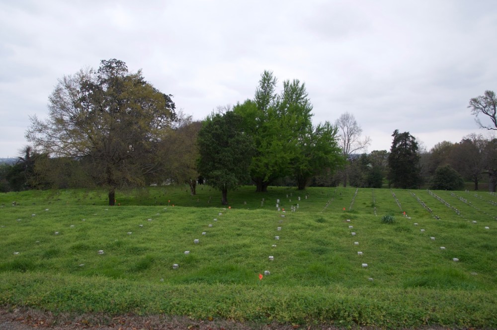
I walked across the street from the Cairo through the gates of the Vicksburg National Cemetery. It sprawls across 116 acres of dedicated land. To my right within the narrow looping road lay a vast field of grave markers, some marked “UNKNOWN” still more just a circular peg of marble bearing a designated number. No names, just numbers. The neat rows of markers are tightly packed as must have been the many bodies that had been exhumed from the surrounding area to find their final resting places together. Knowing that my Great Great Grandfather was probably out there somewhere was of little solace. I had come to find him but was left with a question that I spoke aloud, “George Brockway, where are you?”. I considered walking the loop and had started a short way up the road to the left. It disappeared below the hillside. I was uncertain of the distance the road covered so I returned to the parking lot for my car. In retrospect I could have walked it but driving was much quicker than walking.
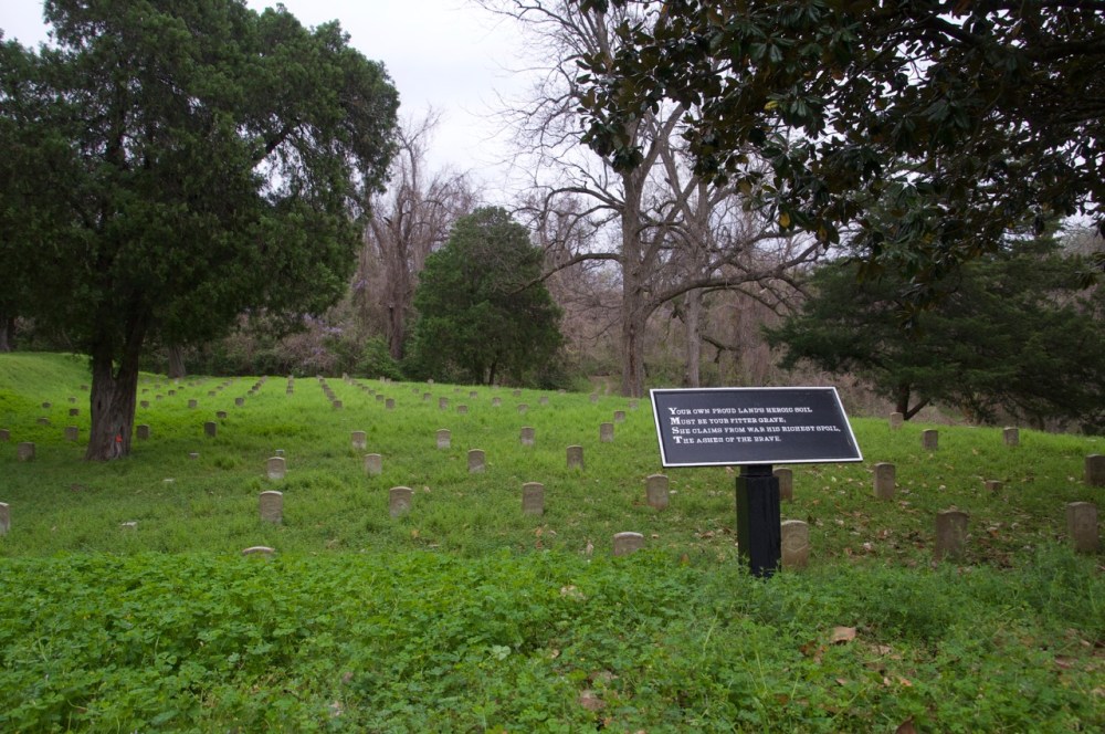
The drive has multiple markers for different known military units. Excerpts from the poem “Bivouac of the Dead” are posted around the circle. I have copied that poem here for your benefit. It is a fitting poem.
“BIVOUAC OF THE DEAD”
by Theodore O’Hara
The muffled drum’s sad roll has beat
The soldier’s last tattoo;
No more on life’s parade shall meet
That brave and fallen few.
On Fame’s eternal camping-ground
Their silent tents are spread,
And Glory guards, with solemn round,
The bivouac of the dead.
No rumor of the foe’s advance
Now swells upon the wind;
Nor troubled thought at midnight haunts
Of loved ones left behind;
No vision of the morrow’s strife
The warrior’s dream alarms;
No braying horn nor screaming fife
At dawn shall call to arms.
Their shriveled swords are red with rust,
Their plumed heads are bowed,
Their haughty banner, trailed in dust,
Is now their martial shroud.
And plenteous funeral tears have washed
The red stains from each brow,
And the proud forms, by battle gashed
Are free from anguish now.
The neighing troop, the flashing blade,
The bugle’s stirring blast,
The charge, the dreadful cannonade,
The din and shout, are past;
Nor war’s wild note nor glory’s peal
Shall thrill with fierce delight
Those breasts that nevermore may feel
The rapture of the fight.
Like the fierce northern hurricane
That sweeps the great plateau,
Flushed with the triumph yet to gain,
Came down the serried foe,
Who heard the thunder of the fray
Break o’er the field beneath,
Knew well the watchword of that day
Was “Victory or death!”
Long had the doubtful conflict raged
O’er all that stricken plain,
For never fiercer fight had waged
The vengeful blood of Spain;
And still the storm of battle blew,
Still swelled the gory tide;
Not long, our stout old chieftain knew,
Such odds his strength could bide.
Twas in that hour his stern command
Called to a martyr’s grave
The flower of his beloved land,
The nation’s flag to save.
By rivers of their father’s gore
His first-born laurels grew,
And well he deemed the sons would pour
Their lives for glory too.
For many a mother’s breath has swept
O’er Angostura’s plain –
And long the pitying sky has wept
Above its moldered slain.
The raven’s scream, or eagle’s flight,
Or shepherd’s pensive lay,
Alone awakes each sullen height
That frowned o’er that dread fray.
Sons of the Dark and Bloody Ground
Ye must not slumber there,
Where stranger steps and tongues resound
Along the heedless air.
Your own proud land’s heroic soil
Shall be your fitter grave;
She claims from war his richest spoil –
The ashes of her brave.
Thus ‘neath their parent turf they rest,
Far from the gory field,
Borne to a Spartan mother’s breast
On many a bloody shield;
The sunshine of their native sky
Smiles sadly on them here,
And kindred eyes and hearts watch by
The heroes sepulcher.
Rest on embalmed and sainted dead!
Dear as the blood ye gave;
No impious footstep shall here tread
The herbage of your grave;
Nor shall your glory be forgot
While fame her records keeps,
Or Honor points the hallowed spot
Where Valor proudly sleeps.
Yon marble minstrel’s voiceless stone
In deathless song shall tell,
When many a vanquished ago has flown,
The story how ye fell;
Nor wreck, nor change, nor winter’s blight,
Nor Time’s remorseless doom,
Shall dim one ray of glory’s light
That gilds your deathless tomb.
After paying my respects to the fallen soldiers, I turned right onto Connecting Avenue then left onto Confederate Avenue. At the top of the hill the road was closed but there was a parking area at Fort Hill. I parked and walked around enjoying the view from Fort Hill. It overlooks the Yazoo River Diversion Canal where the Mississippi used to flow at the time of the Siege of Vicksburg, 1863. The Fort gave the Confederates a huge advantage over the U.S. troops below and a protection of the river. The winds at the top of the bluff were relentless. I had to steady my glasses on my face to hold them in place.
Confederate Avenue was closed to vehicles but I had been advised that it was opened to foot traffic. I walked along the twisting road up and down the hillside past rows of confederate markers and busts until I reached Tennessee Circle. The winds had settled down once I had left the Fort. The large Tennessee monument marked the far end of my walk. I returned on the road back to my car and drove south on Fort Hill Drive where you pass even more Confederate markers. Fort Hill Drive changes to Cherry Street. I continued to Clay Street tuning left toward the Park Visitor Center.
I stopped briefly at the center then returned north through the arch on Union Avenue to Graveyard Road. Graveyard Road is notorious for the failed Union attempt to breach the confederate line at Stockade Redan. This was a turning point in Grants strategy to take Vicksburg. After seeing so many soldiers fall at this and other attempts Grant ceased the direct assaults resolving to starve them out. The Confederates and the citizens suffered equally. The forty seven day siege held until CSA General Pemberton surrendered on July 4, 1863.
I spent an extended time walking along the Confederate line at the Stockade Redan. It was easy to see the advantage the protective overlook gave the southern troops. The valleys below and Graveyard Road made the northern troops easy pickings. Graveyard road meets Confederate Avenue at the eastern closure of Confederate Road. Union road turns south along the Confederate defense lines. It is said that Missouri troops faced off on opposite sides at the battle. Brothers and neighbors literally met during the cease fires to catch up with each other. People reportedly called across to find out the welfare of people they knew.
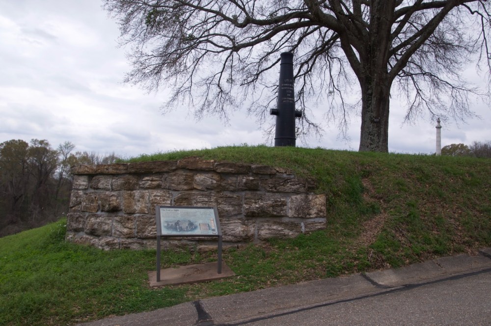
I finished my drive south to the Surrender Interview site between Grant and Pemberton on Pemberton Avenue. The location is marked by an upright cannon and a marker next to an oak tree. It is very inconspicuous. So much so, that I passed it without realizing what it was. I reached the end of the short road and turned around at Union Avenue heading back toward Confederate Avenue. Along the way I stopped to view the cannon memorial.
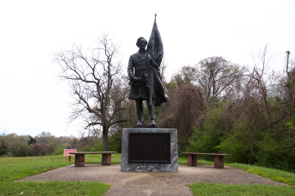
The remainder of Confederate Avenue to the Visitors Center was marked by many monuments. By this time I had seen so many I was driving the speed limit of 25 MPH stopping briefly to see some of the larger memorials. I pulled over at the Second Texas Lunette where there is a picnic area and a statue of Jefferson Davis. Jefferson Davis was a tragic figure who gambled with politics and lost everything. The solum statue seemed to capture this image.
I passed the Jewish Anshe Chesed private cemetery on the right then turned right under Clay Street to drive the loop through the southern most tip of the park. Here at the Railroad Redoubt The Confederate and Union troops engaged in fierce fighting that resulted in the south maintaining control of the railroad. Along the drive I noticed a large number of markers honoring Indiana, Ohio, and Illinois. It seemed the same throughout the park. The Texas and Iowa monuments are the most striking memorials of this section.
At this point I felt I had seen the entire park and all the visible monuments of the 1,340 plus that dot the park. It did not keep me from stopping again on Thursday and Friday to take more photos and fill in some blanks. Keep in mind that there are many memorials outside the park. A clump of Union memorials are located across the street from the Kroger store on Pemberton Square Blvd.. There are also three small sites to visit along Washington Street (Business US 61) overlooking the Mississippi south of Vicksburg: Louisiana Circle; South Fort; and Navy Circle. Louisiana Circle was closed off. I could not visit there. South Fort was easily accessible from a parking lot. Navy Circle can be accessed from the parking lot of the Mississippi Visitor’s Center. Each of these three sites are very small. You can spend as much time as you want at them but there isn’t much to see aside from the hillside and a few cannons. It is worth reading the plaques to gain an insight into the historical significance of these sites.
Take your time. See the park. Read. I saw a lot of people on tours or just passing through. I don’t know how much they got from their visits but know I could have learned more. There’s always more.
Whether you are planning to visit the national park or just want to learn more about Vicksburg, I urge you to visit the official National Parks site: https://www.nps.gov/vick/index.htm

Nice touch with the poem. I enjoyed looking at these pictures.
LikeLike