My travels started with a quick stop at the local Webster, NY Wegmans store at the intersection of Bay Rd. and Empire Blvd. This store caters to an upscale crowd and offers fresh fruits and vegetables, do it yourself salads and meals as well as a premade assortment of sandwiches, salads, pizzas, soups etc.. It is primarily a grocery store but offers an assortment of household items too in the fashion of a small department store. I purchased enough groceries for three days, including salads and a chicken Parmesan dinner with spaghetti and green beans.
I took off down Empire Blvd. while eating a turkey wrap. I had trouble keeping the wrap together. Bacon bits soaked in dressing would fall down my front from time to time, leaving a stained trail. I managed to stay safe by watching the wrap for shifting shapes that foretold a pending avalanche.
The GPS lured me onto 590 South to I490 East which then met up with I-90 East. It was smooth sailing all the way. Dark clouds hung to the north. The front formed a distinct slant to the east. At one point I observed a tail spawning of the edge of the front. It quickly broke apart. It never rained and the winds remained moderate.
I exited the highway at Mohawk turning south onto Main St.. Immediately after crossing the Mohawk River I turned right onto SR 28. SR 28 would take me near my destination however the GPS had other plans.
There was a long delay due to a trucker who could not negotiate the steep hill that leads out of Mohawk. Either he was having mechanical problems or he was highly inexperienced. I voted for the latter. The truck had started up the grade at a slow pace that continued to slow until it was a complete stop in the middle of the hill. I could see him fidgeting with the gears in his side mirrors. a line of cars was gathering behind me and I kept my distance just in case he were to roll backwards. Some drivers ignored the double yellow line and the lack of visual safety as they sped around him.
He managed to get the machine creeping along again and I took the first safe opportunity to pass. We were still on the hill but the passing zone afforded enough visual assuredness to get by the bewildered trucker.
From there SR 28 snakes through farming country and a few villages. My speeds varied from 55MPH to 35 MPH as posted. At the intersection of U.S. 20 I stopped to fuel up at a Sunoco station and use the restrooms at the attached McDonalds. I could have easily gone without fuel but decided to err on the side of caution. Three older looking clean cut men in Harley gear were sipping coffee while there bikes were under cover in the parking lot. The area looked as if a heavy rain had just soaked the the country side. I assumed they had taken refuge.
SR 28 takes a hard left at the US 20 intersection then a hard right in the town of Richfield Springs. The GPS shaved off that corner by keeping me on CR 25A. It is a straight shot that joins onto SR 28 south of town.
At this point the road parallels Canadarago Lake. The speed limit varies between 35 and 40 MPH for most of the length of the lake. At times I wondered if I was coming to a dead end but then the road would open up again after a sharp turn. Cottages line both sides of the road in areas. The speed limit picks up to 55 MPH towards the southern tip of the lake.
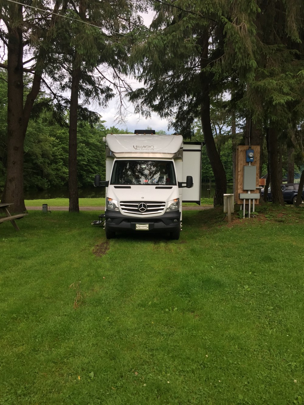
At the gathering of houses known as Oaksville the GPS had me angle onto Bissel Rd.. The visible road sign on the left hand side read Cat Town Road. A smaller less apparent sign on the right read Bissel. It took awhile to find it but I was confident that this was the proper way to go (per GPS). The next direction was to bear right onto Christian Hill Rd.. I was now on country lanes. When a Ram pickup passed from the opposite direction we both hugged the narrow berm. I prayed that it was not so soft that it would grab my front wheel. I was directed to turn left onto Petkewek Rd. The road opened up to two lanes. I was relieved to reach my destination of Cooperstown Family Campground on the left.
I was met in the office by the wife half of the owners. She was very friendly and helpful. I was informed that the GPS directions should not be followed. It would have been easier to take SR 28 into Cooperstown and then catch 11A to Petkewek Rd. just past the campground. Someone needs to tell the GPS programers. I had my pick of several lots and chose one that I could pull into from a gravel road just below the office and barn. It is situated across from the pond. I asked about a fishing license but did not need one because to is a private pond. There is an old barn across from the office with an arcade. Beside that are a pair of turkeys and some goats. The turkeys are kept in an old wire silo while the goats roam about in a fenced in area. From time to time you can hear a peacock who resides in a pen near the barn with a peahen.
I got set up with electric and water connections. The water pressure topped out at 30 PSI. There was no danger of blowing any gaskets. I then tried my hand at fishing with some lures. The fishing was cut short by a thunderstorm that lasted most of the night. It was a brisk 60 degrees. It got even colder overnight. There was no need to run the A/C and the windows remained closed.
I hooked up my external TV antenna and had no reception. No Jeopardy. My meal was the microwaved chicken Parmesan. It worked for me. I decided to watch a two part Nero Wolfe show, Champagne for One. I am about halfway through reading the Nero Wolfe series. That makes for 26 books down. If I can’t find the books at least I can watch the A&E TV series.The night was cold but I stayed warm in bed with the sheets and blanket.
